How does it work?
A Mapolitical User can draw freehand a polygon around any location found on a UK Map down to street level immediately finding all the local VIP stakeholders within the selected Area.
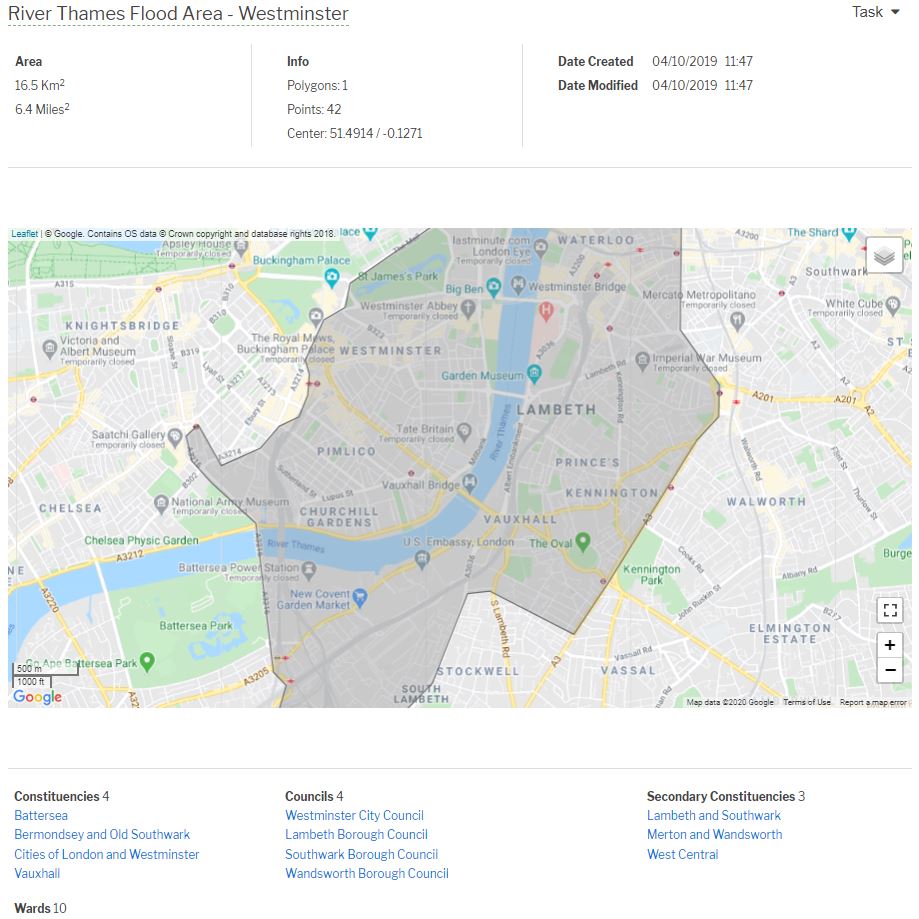
At a time of a disaster or incident, within 10 seconds all the key people you would need to contact can be found e.g. MPs, Ward Councillors, Senior Councillors, Key Local Authority Officers, Parish Council Clerks, MSPs, Welsh AMs, GLA Members, Police, Emergency Services and consultants, Hospitals, NHS plus any bespoke VIP researched stakeholders.A typical hand drawn polygon is shown in the above graphic shaded area.
This search also applies to any selected UK area including a group of public or secure assets, rail or road routes, towns or regions, disaster zones, flood areas, explosions and disaster area-spread.
Map-Draw used in conjunction with Map-Media will also find all local media which covers the selected drawn area e.g. editors and news desks of Local and National Newspapers, TV and Radio.
Applications
The above graphic shows the hand-drawn polygon of the Westminster basin flood plain and the key Constituencies and Councils contained within the selected area. Indeed, using Mapolitical this consists of at over 200 key stakeholders and their contact details for mail merge communication purposes.
Map-Draw allows communication with local communities either as a daily project update for PR and Public Affairs e.g. news-letters, issues and opportunities, or at a time of a serious issue (flood, explosion, evacuation, disease etc.) a vital communication tool to key stakeholders and citizens in distress.